| Lao Mercure | |
|---|---|
 | |
 | |
| Location | |
| Country | Italy |
| Physical characteristics | |
| Source | Serra del Prete |
| • location | Pollino massif, Basilicata |
| • coordinates | 39°58′13″N 16°8′42″E / 39.97028°N 16.14500°E |
| • elevation | 2,181 m (7,156 ft) |
| Mouth | Tyrrhenian Sea |
• location | Scalea, Calabria |
• coordinates | 39°46′36″N 15°47′39″E / 39.77667°N 15.79417°E |
• elevation | 0 m (0 ft) |
| Length | 51 km (32 mi) |
| Basin size | 594 km2 (229 sq mi) |
| Discharge | |
| • average | 12.1 m3/s (430 cu ft/s) |

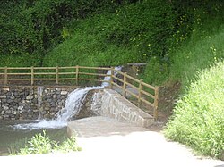
The Lao (Greek: Λᾶος; Latin: Laus, Laos or Laüs; formerly also Laino) is a river in southern Italy. It rises in the Lucanian Apennines in Basilicata (where it is known as the Mercure) and drains into the Tyrrhenian Sea near Scalea in Calabria.