Laramie County | |
|---|---|
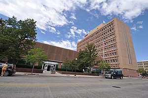
 United States Post Office and Courthouse, Cheyenne, Wyoming | |
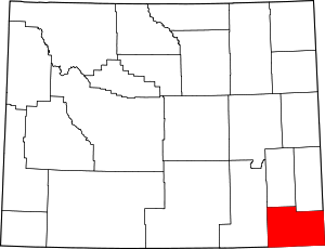
 Location within the U.S. state of Wyoming | |
 Wyoming's location within the U.S. | |
| Coordinates: 41°19′N 104°41′W / 41.32°N 104.69°W | |
| Country | |
| State | |
| Founded | January 9, 1867 |
| Named for | Jacques La Ramee |
| Seat | Cheyenne |
| Largest city | Cheyenne |
| Area | |
• Total | 2,688 sq mi (6,960 km2) |
| • Land | 2,686 sq mi (6,960 km2) |
| • Water | 1.6 sq mi (4 km2) 0.06% |
| Population (2020) | |
• Total | 100,512 |
| • Density | 37.39/sq mi (14.44/km2) |
| Time zone | UTC−7 (Mountain) |
| • Summer (DST) | UTC−6 (MDT) |
| Congressional district | At-large |
| Website | laramiecounty |
Laramie County is a county located at the southeast corner of the state of Wyoming. As of the 2020 United States Census, the population was 100,512 or 17.4% of the state's total 2020 population,[1] making it the most populous county in Wyoming, but the least populous county in the United States to be the most populous in its state.
The county seat is Cheyenne, the state capital.[2] The county lies west of the Nebraska state line and north of the Colorado state line.
Laramie County comprises the Cheyenne, WY Metropolitan Statistical Area.
The city of Laramie, Wyoming, is in neighboring Albany County.
- ^ "State & County QuickFacts".
- ^ "Find a County". National Association of Counties. Retrieved June 7, 2011.
