| Las Garzas Creek | |
|---|---|
 Carmel River Watershed Map with major tributaries, National Marine Fisheries Service 2013 | |
| Location | |
| Country | United States |
| State | California |
| Region | Monterey County |
| Municipality | Carmel Valley, California |
| Physical characteristics | |
| Source | Southern flank of Patriarch Ridge, on the northeastern slope of the Santa Lucia Range |
| • coordinates | 36°26′20″N 121°51′17″W / 36.43889°N 121.85472°W[3] |
| • elevation | 2,814 ft (858 m) |
| Mouth | Confluence with the Carmel River |
• location | Carmel Valley, California |
• coordinates | 36°29′32″N 121°45′04″W / 36.49222°N 121.75111°W[3] |
• elevation | 217 ft (66 m)[3] |
| Basin features | |
| Tributaries | |
| • right | Salsipuedes Creek, Cienega Creek |
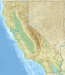
Las Garzas Creek is a 9.0-mile-long (14.5 km)[4] northeastward-flowing stream, the lowermost major tributary of the Carmel River. It originates about 1.2 miles (1.9 km) southeast of Palo Corona summit[5] on a saddle between Patriarch Ridge[6] and an unnamed peak to its south. This saddle is part of the east-west watershed divide of the northern Santa Lucia Range.[7] The creek flows almost entirely through the Santa Lucia Preserve to its confluence with the Carmel River in Carmel Valley, Monterey County, California.[2]
- ^ Erwin G. Gudde; William Bright (2010). California Place Names–The Origin and Etymology of Current Geographical Names. Berkeley, California: University of California Press. p. 141. ISBN 978-0-520-26619-3.
- ^ a b Donald Thomas Clark (1991). Monterey County Place Names: A Geographical Dictionary. Irvine, Scotland: Kestrel Press. ISBN 978-1-880478-00-4.
- ^ a b c "Las Garzas Creek". Geographic Names Information System. United States Geological Survey, United States Department of the Interior.
- ^ U.S. Geological Survey. National Hydrography Dataset high-resolution flowline data. The National Map Archived March 29, 2012, at the Wayback Machine, accessed March 15, 2011
- ^ U.S. Geological Survey Geographic Names Information System: Palo Corona
- ^ "Patriarch Ridge". Big Sur Land Trust. Retrieved September 30, 2022.
- ^ "Santa Lucia Range". Geographic Names Information System. United States Geological Survey, United States Department of the Interior.
