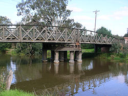
The Latrobe River (or sometimes La Trobe[2] or LaTrobe) is a perennial river of the West Gippsland catchment, located in the West Gippsland region of the Australian state of Victoria. The Latrobe River and its associated sub-catchment is an important source for the Gippsland Lakes, draining the south eastern slopes of the Great Dividing Range.
- ^ a b "Latrobe River: 19128". Vicnames. Government of Victoria. 2 May 1966. Retrieved 25 June 2015.
- ^ a b "La Trobe River". Gazetteer of Australia online. Geoscience Australia, Australian Government.
- ^ Blake, Les (1977). Place names of Victoria. Adelaide: Rigby. p. 294. ISBN 0-727-00250-3.
- ^ Reed, A. W. (1973). Place names of Australia. Frenchs Forest: Reed Books. p. 135. ISBN 0-589-50128-3.
- ^ "Map of Latrobe River, VIC". Bonzle Digital Atlas of Australia. Retrieved 8 February 2014.
- ^ "Latrobe River: 19128: Traditional Name: Durt'yowan". Vicnames. Government of Victoria. 12 August 2011. Archived from the original on 22 February 2014. Retrieved 25 June 2015.
- ^ "Latrobe River: 19128: Traditional Name: Durt'yowan". Vicnames. Government of Victoria. 12 May 2011. Archived from the original on 22 February 2014. Retrieved 25 June 2015.
- ^ "Latrobe River: 19128: Traditional Name: Tanjil". Vicnames. Government of Victoria. 12 August 2011. Archived from the original on 22 February 2014. Retrieved 25 June 2015.

