Lattrop | |
|---|---|
village | |
 View on Lattrop | |
| Nickname: Droadneagels | |
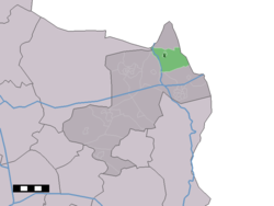
 The village centre (dark green) and the statistical district (light green) of Lattrop in the municipality of Dinkelland. | |
| Coordinates: 52°25′40″N 6°58′31″E / 52.42778°N 6.97528°E | |
| Country | Netherlands |
| Province | Overijssel |
| Municipality | Dinkelland |
| Area | |
| • Total | 10.90 km2 (4.21 sq mi) |
| Elevation | 19 m (62 ft) |
| Population | |
| • Total | 810 |
| • Density | 74/km2 (190/sq mi) |
| Demonym | Lattroppers |
| Time zone | UTC+1 (CET) |
| • Summer (DST) | UTC+2 (CEST) |
| Postal code | 7635[1] |
| Dialing code | 0541 |
Lattrop is a village in the Dutch province of Overijssel. It is a part of the municipality of Dinkelland, and lies about 13 km north of Oldenzaal.
- ^ a b c "Kerncijfers wijken en buurten 2021". Central Bureau of Statistics. Retrieved 15 March 2022.
Two entires
- ^ "Postcodetool for 7635AA". Actueel Hoogtebestand Nederland (in Dutch). Het Waterschapshuis. Retrieved 15 March 2022.

