Laurel Mountain, Pennsylvania | |
|---|---|
 Locust Street | |
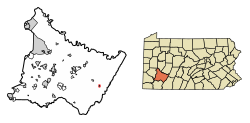
 Location of Laurel Mountain in Westmoreland County, Pennsylvania. | |
| Coordinates: 40°12′41″N 79°11′04″W / 40.21139°N 79.18444°W | |
| Country | United States |
| State | Pennsylvania |
| County | Westmoreland |
| Settled | 1926 |
| Incorporated | 1982 |
| Government | |
| • Type | Borough Council |
| Area | |
| • Total | 0.13 sq mi (0.33 km2) |
| • Land | 0.13 sq mi (0.33 km2) |
| • Water | 0.00 sq mi (0.00 km2) |
| Elevation | 1,421 ft (433 m) |
| Population | |
| • Total | 146 |
| • Density | 1,131.78/sq mi (436.81/km2) |
| Time zone | UTC-5 (Eastern (EST)) |
| • Summer (DST) | UTC-4 (EDT) |
| Zip code | 15655 |
| FIPS code | 42-41834 |
| Website | Official borough website |
Laurel Mountain is a borough that is located in Westmoreland County, Pennsylvania, United States. The population was 185 at the time of the 2000 census.
Situated at the foot of Laurel Mountain (elev. 2,800 ft.), the borough lies near numerous limestone caves and is surrounded by venues for skiing, hiking, and other outdoor activities.
- ^ "ArcGIS REST Services Directory". United States Census Bureau. Retrieved October 12, 2022.
- ^ Cite error: The named reference
USCensusDecennial2020CenPopScriptOnlywas invoked but never defined (see the help page).
