| Lava Fire | |
|---|---|
 Air tanker dropping retardant on Lava Fire | |
| Date(s) | July 23, 2012 – August 15, 2012 |
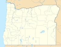
| Location | Lake County, Oregon, U.S. |
| Coordinates | 43°29′21″N 120°45′26″W / 43.4892°N 120.7572°W |
| Statistics | |
| Burned area | 21,546 acres (87 km2) |
| Land use | Public rangeland and lava beds |
| Ignition | |
| Cause | Lightning |
| Map | |
The Lava Fire was a wildfire that burned over 21,500 acres (87 km2) of Oregon rangeland during the summer of 2012. The fire began on 23 July 2012, the result of a lightning strike. The fire consumed rangeland vegetation and scrub forest located in and around lava beds in northern Lake County. The burned area was on public land administered by the Bureau of Land Management including a large area within a wilderness study area. Firefighters battled the blaze for over three weeks. At the peak of the firefighting effort, there were over 275 personnel working on the fire.
