Lavik Municipality
Lavik herad | |
|---|---|
| Ladvig herred (historic name) | |
 View of the village of Lavik | |
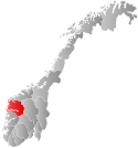
 Sogn og Fjordane within Norway | |
 Lavik within Sogn og Fjordane | |
| Coordinates: 61°06′17″N 05°30′37″E / 61.10472°N 5.51028°E | |
| Country | Norway |
| County | Sogn og Fjordane |
| District | Sogn |
| Established | 1 Jan 1838 |
| • Created as | Formannskapsdistrikt |
| Disestablished | 1 Jan 1861 |
| • Succeeded by | Lavik og Brekke Municipality |
| Re-established | 1 Jan 1905 |
| • Preceded by | Lavik og Brekke Municipality |
| Disestablished | 1 Jan 1964 |
| • Succeeded by | Høyanger Municipality |
| Administrative centre | Lavik |
| Area (upon dissolution) | |
| • Total | 220 km2 (80 sq mi) |
| Population (1964) | |
| • Total | 894 |
| • Density | 4.1/km2 (11/sq mi) |
| Time zone | UTC+01:00 (CET) |
| • Summer (DST) | UTC+02:00 (CEST) |
| ISO 3166 code | NO-1415[1] |
Lavik is a former municipality in the old county of Sogn og Fjordane, Norway. It was located in the western part of the present-day municipality of Høyanger which is in Vestland county. The municipality was mostly on the northern side of the Sognefjorden. A small part of Lavik was located on the southern side of the Sognefjorden, a narrow strip of land running south around the Ikjefjorden, past the village of Øystrebø, all the way south to the border with Hordaland county. The municipality of Lavik existed from 1838 until 1861 and then again from 1905 until 1964. Upon its dissolution, the municipality was 220 square kilometres (85 sq mi). The administrative centre of the municipality was the village of Lavik where Lavik Church is located.[2]
- ^ Bolstad, Erik; Thorsnæs, Geir, eds. (26 January 2023). "Kommunenummer". Store norske leksikon (in Norwegian). Kunnskapsforlaget.
- ^ Store norske leksikon. "Lavik. – tidl. kommune" (in Norwegian). Retrieved 17 January 2014.