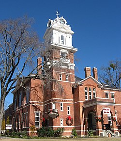
Lawrenceville, Georgia | |
|---|---|
 | |
| Nickname: The Crepe Myrtle City | |
| Coordinates: 33°57′08″N 83°59′36″W / 33.95222°N 83.99333°W | |
| Country | United States |
| State | Georgia |
| County | Gwinnett |
| Named for | James Lawrence |
| Government | |
| • Type | Mayor-council government |
| • Mayor | David Still |
| Area | |
• Total | 13.80 sq mi (35.73 km2) |
| • Land | 13.69 sq mi (35.46 km2) |
| • Water | 0.11 sq mi (0.28 km2) |
| Elevation | 1,083 ft (330 m) |
| Population (2020) | |
• Total | 30,629 |
| • Density | 2,237.33/sq mi (863.83/km2) |
| Time zone | UTC-5 (Eastern (EST)) |
| • Summer (DST) | UTC-4 (EDT) |
| ZIP codes | 30042-30046, 30049 |
| Area code | 404/678/770 |
| FIPS code | 13-45488[3] |
| GNIS feature ID | 2404897[2] |
| Website | www |
Lawrenceville is a city in and the county seat of Gwinnett County, Georgia, United States.[4] It is a suburb of Atlanta, located approximately 30 miles (50 km) northeast of downtown. It was incorporated on December 15, 1821. As of the 2020 census, the population of Lawrenceville was 30,629.[5]
- ^ "2020 U.S. Gazetteer Files". United States Census Bureau. Archived from the original on March 18, 2021. Retrieved December 18, 2021.
- ^ a b U.S. Geological Survey Geographic Names Information System: Lawrenceville, Georgia
- ^ "U.S. Census website". United States Census Bureau. Archived from the original on July 9, 2021. Retrieved January 31, 2008.
- ^ "Find a County". National Association of Counties. Archived from the original on July 12, 2012. Retrieved June 7, 2011.
- ^ "Population and Housing Unit Estimates". Archived from the original on July 1, 2021. Retrieved May 21, 2020.


