Le Mont-Dore | |
|---|---|
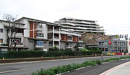
 The High Street, Le Mont-Dore | |
 Location of the commune (in red) within New Caledonia | |
| Coordinates: 22°12′57″S 166°27′59″E / 22.2157°S 166.4665°E | |
| Country | France |
| Sui generis collectivity | New Caledonia |
| Province | South Province |
| Government | |
| • Mayor (2020–2026) | Eddie Lecourieux[1] |
| Area 1 | 643.0 km2 (248.3 sq mi) |
| Population (2019)[2] | 27,620 |
| • Density | 43/km2 (110/sq mi) |
| Ethnic distribution | |
| • 2019 | Europeans 26.36% Kanaks 24.86% Wallisians and Futunans 14.8% Mixed 15.34% Other 18.65% |
| Time zone | UTC+11:00 |
| INSEE/Postal code | 98817 /98809 |
| Elevation | 0–825 m (0–2,707 ft) (avg. 20 m or 66 ft) |
| 1 New Caledonia Land Register (DITTT) data, which exclude lakes and ponds larger than 1 km² (0.386 sq mi or 247 acres) as well as the estuaries of rivers. | |
Le Mont-Dore (French pronunciation: [lə mɔ̃ dɔʁ]) is a commune in the suburbs of Nouméa in the South Province of New Caledonia, an overseas territory of France[3] in the Pacific Ocean.
- ^ "Répertoire national des élus: les maires" (in French). data.gouv.fr, Plateforme ouverte des données publiques françaises. 4 May 2022.
- ^ Population, ménages et logement par commune, en 2019, Institut de la statistique et des études économiques Nouvelle-Calédonie
- ^ "Commune du Mont-Dore, Nouvelle-Calédonie". Commune du Mont-Dore.

