This article needs additional citations for verification. (September 2023) |
Lecompton, Kansas | |
|---|---|
 1857 Constitution Hall (2009) | |
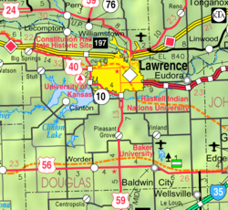
 Location within Douglas County and Kansas | |
 | |
| Coordinates: 39°2′40″N 95°23′41″W / 39.04444°N 95.39472°W[1] | |
| Country | United States |
| State | Kansas |
| County | Douglas |
| Founded | 1854 |
| Incorporated | 1855 |
| Named for | Samuel Dexter Lecompte |
| Area | |
| • Total | 1.76 sq mi (4.57 km2) |
| • Land | 1.76 sq mi (4.55 km2) |
| • Water | 0.01 sq mi (0.02 km2) |
| Elevation | 925 ft (282 m) |
| Population | |
| • Total | 588 |
| • Density | 330/sq mi (130/km2) |
| Time zone | UTC-6 (CST) |
| • Summer (DST) | UTC-5 (CDT) |
| ZIP code | 66050 |
| Area code | 785 |
| FIPS code | 20-39150 |
| GNIS ID | 2395667[1] |
| Website | lecompton.org |
Lecompton (pronounced /lɪˈkɒmptən/)[4] is a city in Douglas County, Kansas, United States.[1] As of the 2020 census, the population of the city was 588.[3] Lecompton, located on the Kansas River, was the de jure territorial capital of Kansas from 1855 to 1861, and the Douglas County seat from 1855 to 1858. Anti-slavery Lawrence became the de facto capital during the latter part of this period, when the county seat was moved there. This time period was known as Bleeding Kansas, due to the violence perpetrated by the pro-slavery, and to a lesser extent the anti-slavery, factions in the eastern part of the state. Lecompton was a hotbed of pro-slavery sentiment during the mid-1800s.
- ^ a b c d U.S. Geological Survey Geographic Names Information System: Lecompton, Kansas
- ^ "2019 U.S. Gazetteer Files". United States Census Bureau. Retrieved July 24, 2020.
- ^ a b "Profile of Lecompton, Kansas in 2020". United States Census Bureau. Archived from the original on November 12, 2022. Retrieved November 12, 2022.
- ^ William Allen White School of Journalism and Public Information (1955). A pronunciation guide to Kansas place names. Lawrence, KS: University of Kansas. p. 15. hdl:2027/mdp.39015047651115.