Leelanau County | |
|---|---|
 | |
| Nickname: "Michigan's Little Finger" | |
 Location within the U.S. state of Michigan | |
 Michigan's location within the U.S. | |
| Coordinates: 45°08′N 86°02′W / 45.13°N 86.03°W | |
| Country | |
| State | |
| Founded | 1840 (created) 1863 (organized)[1] |
| Named for | Leelanau Peninsula |
| Seat | Suttons Bay Township |
| Largest settlement | Greilickville Suttons Bay (incorporated) |
| Area | |
• Total | 2,532 sq mi (6,560 km2) |
| • Land | 347 sq mi (900 km2) |
| • Water | 2,185 sq mi (5,660 km2) 86% |
| Population (2020) | |
• Total | 22,301 |
• Estimate (2023) | 23,019 |
| • Density | 63/sq mi (24/km2) |
| Time zone | UTC−5 (Eastern) |
| • Summer (DST) | UTC−4 (EDT) |
| Congressional district | 1st |
| Website | www |
Leelanau County (/ˈliːlənɔː/ LEE-lə-naw) is a county located in the U.S. state of Michigan. As of the 2020 census, the population was 22,301.[2] Since 2008, the county seat has been located within Suttons Bay Township, one mile east of the unincorporated village of Lake Leelanau.[3] Before 2008, Leelanau County's seat was Leland.[4] Leelanau County is included in the Traverse City metropolitan area of Northern Michigan. The largest settlement in Leelanau County by population is Greilickville, itself a suburb of Traverse City.
Leelanau County is coterminous with the Leelanau Peninsula, a roughly triangular-shaped peninsula that extends about 30 miles (50 km) off of Michigan's Lower Peninsula into Lake Michigan. East of Leelanau County is Grand Traverse Bay, a bay of Lake Michigan.
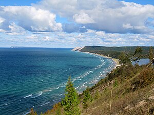
In 2011, the Sleeping Bear Dunes National Lakeshore, located in the county, won the title of "Most Beautiful Place in America" in a poll by morning news show Good Morning America.
- ^ Cite error: The named reference
clarkewas invoked but never defined (see the help page). - ^ "State & County QuickFacts". US Census Bureau. Retrieved September 15, 2021.
- ^ "'Nutcracker' performances set - www.leelanaunews.com - Leelanau Enterprise". leelanaunews.com. Archived from the original on June 8, 2011. Retrieved February 24, 2022.
- ^ "Find a County". National Association of Counties. Retrieved June 7, 2011.

