Leicester Airport | |||||||||||||||||||||||||||
|---|---|---|---|---|---|---|---|---|---|---|---|---|---|---|---|---|---|---|---|---|---|---|---|---|---|---|---|
 | |||||||||||||||||||||||||||
| Summary | |||||||||||||||||||||||||||
| Airport type | Private | ||||||||||||||||||||||||||
| Operator | Leicestershire Aero Club | ||||||||||||||||||||||||||
| Location | Stoughton, Leicestershire | ||||||||||||||||||||||||||
| Elevation AMSL | 469 ft / 143 m | ||||||||||||||||||||||||||
| Coordinates | 52°36′28″N 001°01′55″W / 52.60778°N 1.03194°W | ||||||||||||||||||||||||||
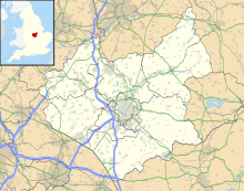
| Map | |||||||||||||||||||||||||||
 | |||||||||||||||||||||||||||
| Runways | |||||||||||||||||||||||||||
| |||||||||||||||||||||||||||
Leicester Airport (IATA: None, ICAO: EGBG) is an aerodrome located to the east of Stoughton, Leicestershire, England, about 5 nautical miles (9.3 km; 5.8 mi) east of Leicester City Centre by road.[1][2] The Leicestershire Aero Club Limited, the airport operator, provide elementary flight training, experience flights and the airport is home to a wide variety of private aircraft. The airfield was constructed in 1942 as part of the former RAF station, RAF Leicester East. The facility was named Stoughton Aerodrome prior to 1974.

The airport has a CAA Ordinary Licence (Number P720) that allows flights for the public transport of passengers or for flying instruction as authorised by the licensee—Leicestershire Aero Club Limited.[3] However, the airport does not currently operate public transport services.
Air Traffic Services, in the form of air-ground communication are provided by "Leicester Radio" on a frequency of 122.130 MHz.[4]
- ^ a b Leicester – EGBG
- ^ Cite error: The named reference
2011crashwas invoked but never defined (see the help page). - ^ Civil Aviation Authority Aerodrome Ordinary Licences Archived 28 June 2007 at the Wayback Machine
- ^ NATS Aeronautical Information Service
