| Leigh | |
|---|---|
 | |
Location within Kent | |
| Area | 16.18 km2 (6.25 sq mi) |
| Population | 1,793 [1] |
| • Density | 111/km2 (290/sq mi) |
| OS grid reference | TQ555465 |
| District | |
| Shire county | |
| Region | |
| Country | England |
| Sovereign state | United Kingdom |
| Post town | Tonbridge |
| Postcode district | TN11 |
| Dialling code | 01732 |
| Police | Kent |
| Fire | Kent |
| Ambulance | South East Coast |
| UK Parliament | |
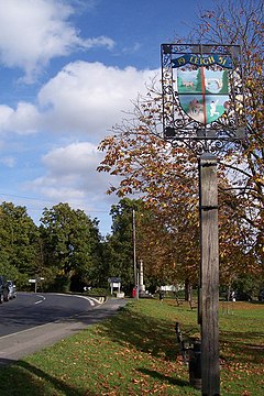
Leigh /ˈlaɪ/, historically spelled Lyghe, is a village and a civil parish located in the Sevenoaks district of Kent, England. It is located six miles (10 km) south of Sevenoaks town and three miles (5 km) west of Tonbridge.
There is a large village green; nearby is Hall Place, once Leigh Hall, occasionally open to the public, built in 1876. The parish church (13th century) is dedicated to St Mary.
- ^ Census, 2011
