Leka Municipality
Leka kommune | |
|---|---|
 Skeisnesset geological reserve | |
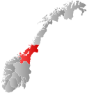
 Trøndelag within Norway | |
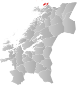
 Leka within Trøndelag | |
| Coordinates: 65°05′17″N 11°37′01″E / 65.08806°N 11.61694°E | |
| Country | Norway |
| County | Trøndelag |
| District | Namdalen |
| Established | 1 Oct 1860 |
| • Preceded by | Kolvereid Municipality |
| Administrative centre | Leknes |
| Government | |
| • Mayor (2023) | Svein Pettersen (Sp) |
| Area | |
| • Total | 110.12 km2 (42.52 sq mi) |
| • Land | 108.33 km2 (41.83 sq mi) |
| • Water | 1.79 km2 (0.69 sq mi) 1.6% |
| • Rank | #326 in Norway |
| Highest elevation | 588.28 m (1,930.05 ft) |
| Population (2024) | |
| • Total | 604 |
| • Rank | #349 in Norway |
| • Density | 5.5/km2 (14/sq mi) |
| • Change (10 years) | |
| Demonym | Lekværing[2] |
| Official language | |
| • Norwegian form | Neutral |
| Time zone | UTC+01:00 (CET) |
| • Summer (DST) | UTC+02:00 (CEST) |
| ISO 3166 code | NO-5052[4] |
| Website | Official website |
Leka is a municipality in Trøndelag county, Norway. It is part of the Namdalen region. The administrative centre of the municipality is the village of Leknes on the island of Leka. Other villages in Leka include Sør-Gutvika and Madsøygrenda.


The 110-square-kilometre (42 sq mi) municipality is the 326th largest by area out of the 357 municipalities in Norway. Leka is the 349th most populous municipality in Norway with a population of 604. The municipality's population density is 5.5 inhabitants per square kilometre (14/sq mi) and its population has increased by 8.6% over the previous 10-year period.[5][6]
The island municipality includes all of the island of Leka and part of the island of Austra as well as hundreds of smaller surrounding islands and skerries. Primarily a fishing and farming community, Leka is the northernmost municipality in Trøndelag county. The island of Leka has been inhabited for at least 10,000 years, as evidenced by cave drawings in the Solsem cave at the southwest tip of the Leka island.
- ^ "Høgaste fjelltopp i kvar kommune" (in Norwegian). Kartverket. 16 January 2024.
- ^ "Navn på steder og personer: Innbyggjarnamn" (in Norwegian). Språkrådet.
- ^ "Forskrift om målvedtak i kommunar og fylkeskommunar" (in Norwegian). Lovdata.no.
- ^ Bolstad, Erik; Thorsnæs, Geir, eds. (26 January 2023). "Kommunenummer". Store norske leksikon (in Norwegian). Kunnskapsforlaget.
- ^ Statistisk sentralbyrå. "Table: 06913: Population 1 January and population changes during the calendar year (M)" (in Norwegian).
- ^ Statistisk sentralbyrå. "09280: Area of land and fresh water (km²) (M)" (in Norwegian).

