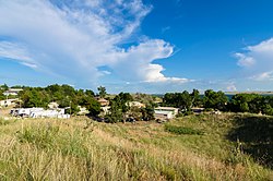
Lemoyne, Nebraska | |
|---|---|
 | |
| Coordinates: 41°16′36″N 101°48′48″W / 41.27667°N 101.81333°W | |
| Country | United States |
| State | Nebraska |
| County | Keith |
| Founded | 1911 |
| Area | |
| • Total | 0.51 sq mi (1.32 km2) |
| • Land | 0.51 sq mi (1.32 km2) |
| • Water | 0.00 sq mi (0.00 km2) |
| Elevation | 3,347 ft (1,020 m) |
| Population (2020) | |
| • Total | 44 |
| • Density | 86.27/sq mi (33.33/km2) |
| Time zone | UTC-6 (Central (CST)) |
| • Summer (DST) | UTC-5 (CDT) |
| ZIP code | 69146 |
| FIPS code | 31-26595 |
| GNIS feature ID | 2583887[2] |
Lemoyne is an unincorporated community and census-designated place in northwestern Keith County, Nebraska, United States. As of the 2010 census it had a population of 82.[3]
It lies along Nebraska Highway 92 on the northern shore of Lake C.W. McConaughy, 20 miles (32 km) by road north of the city of Ogallala, the county seat of Keith County.[4]
Although Lemoyne is unincorporated, it has a post office, with the ZIP code of 69146.[5]
| Census | Pop. | Note | %± |
|---|---|---|---|
| 2020 | 44 | — | |
| U.S. Decennial Census[6] | |||
- ^ "ArcGIS REST Services Directory". United States Census Bureau. Retrieved September 18, 2022.
- ^ a b U.S. Geological Survey Geographic Names Information System: Lemoyne, Nebraska
- ^ "Geographic Identifiers: 2010 Census Summary File 1 (G001), Lemoyne CDP, Nebraska". American FactFinder. U.S. Census Bureau. Archived from the original on February 13, 2020. Retrieved April 11, 2019.
- ^ Rand McNally. The Road Atlas '08. Chicago: Rand McNally, 2008, p. 62.
- ^ Zip Code Lookup
- ^ "Census of Population and Housing". Census.gov. Retrieved June 4, 2016.

