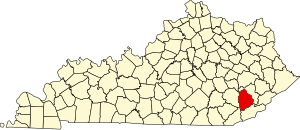
Leslie County | |
|---|---|
 Leslie County courthouse in Hyden | |
 Location within the U.S. state of Kentucky | |
 Kentucky's location within the U.S. | |
| Coordinates: 37°05′N 83°23′W / 37.09°N 83.38°W | |
| Country | |
| State | |
| Founded | 1878 |
| Named for | Preston Leslie |
| Seat | Hyden |
| Largest city | Hyden |
| Area | |
| • Total | 404 sq mi (1,050 km2) |
| • Land | 401 sq mi (1,040 km2) |
| • Water | 3.6 sq mi (9 km2) 0.9% |
| Population (2020) | |
| • Total | 10,513 |
| • Estimate (2023) | 9,864 |
| • Density | 26/sq mi (10/km2) |
| Time zone | UTC−5 (Eastern) |
| • Summer (DST) | UTC−4 (EDT) |
| Congressional district | 5th |
| Website | www |
Leslie County is a county located in the U.S. state of Kentucky. Its county seat and largest city is Hyden.[1] As of the 2020 census, the population was 10,513.[2] It was formed in 1878 from portions of Clay, Harlan, and Perry counties, and named for Preston Leslie, governor of Kentucky from 1871 to 1875.[3]
- ^ "Find a County". National Association of Counties. Archived from the original on May 31, 2011. Retrieved June 7, 2011.
- ^ Cite error: The named reference
GR2was invoked but never defined (see the help page). - ^ "Leslie County (KY) Free Blacks and Free Mulattoes, 1880-1910 · Notable Kentucky African Americans Database". nkaa.uky.edu. Retrieved July 6, 2023.
