Letenye District
Letenyei járás | |
|---|---|
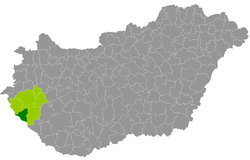
 Letenye District within Hungary and Zala County. | |
| Coordinates: 46°26′N 16°44′E / 46.43°N 16.73°E | |
| Country | |
| County | Zala |
| District seat | Letenye |
| Area | |
• Total | 388.69 km2 (150.07 sq mi) |
| • Rank | 5th in Zala |
| Population (2011 census) | |
• Total | 16,410 |
| • Rank | 5th in Zala |
| • Density | 42/km2 (110/sq mi) |
Letenye (Hungarian: Letenyei járás) is a district in south-western part of Zala County. Letenye is also the name of the town where the district seat is found. The district is located in the Western Transdanubia Statistical Region.
