You can help expand this article with text translated from the corresponding article in Spanish. (April 2018) Click [show] for important translation instructions.
|
Libertador
Municipio Bolivariano Libertador | |
|---|---|
Municipality | |
| Libertador Bolivarian Municipality | |
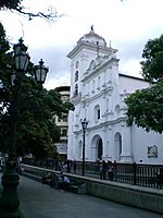
 Caracas Cathedral | |
 Capital District | |
| Coordinates: 10°30′21″N 66°54′52″W / 10.50583°N 66.91444°W | |
| Country | |
| State | Capital District |
| Founded | 25 July 1567 |
| Government | |
| • Type | Mayor–council |
| • Mayor | Erika Farías (PSUV) |
| Area | |
| • Metro | 433 km2 (167 sq mi) |
| Population (2007) | |
• Municipality | 2,085,488 |
| • Density | 4,816.36/km2 (12,474.3/sq mi) |
| Time zone | UTC−4 (VET) |
| Area code | 212 |
| ISO 3166 code | VE-A |
| Website | http://www.caracas.gob.ve |
| The area and population figures are for the municipality. | |
The Libertador Bolivarian Municipality (Spanish: Municipio Bolivariano Libertador) is the only administrative division of the Capital District of Venezuela and along with the municipalities of Baruta, Chacao, El Hatillo and Sucre forms the Metropolitan District of Caracas. It is landlocked by Vargas State and also borders Miranda State on the east and south. The municipality is one of a number in Venezuela named "Libertador Municipality", in honour of Venezuelan independence hero Simón Bolívar.
Libertador is one of the smallest municipalities in Venezuela, with a total area of 438 square kilometres (169 sq mi). It is the largest in terms of population, with approximately 2.1 million inhabitants.
In this municipality is home to the Miraflores presidential palace, the Federal Legislative Palace, the National Electoral Council, the main offices of PDVSA and CANTV, the Central Bank of Venezuela and the public ministry.
