 NASA picture of Likiep Atoll | |
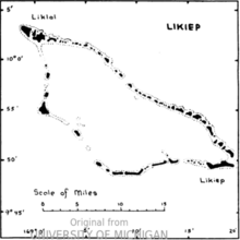
 Map of the atoll | |
| Geography | |
|---|---|
| Location | North Pacific |
| Coordinates | 09°54′00″N 169°08′00″E / 9.90000°N 169.13333°E |
| Archipelago | Ratak |
| Total islands | 65 |
| Area | 10.26 km2 (3.96 sq mi) |
| Highest elevation | 10 m (30 ft) |
| Administration | |
| Demographics | |
| Population | 228 (2021) |
| Ethnic groups | Marshallese |
Likiep Atoll (Marshallese: Likiep, [lʲiɡiɛpʲ][1]) is a coral atoll of 65 islands in the Pacific Ocean, and forms a legislative district of the Ratak Chain of the Marshall Islands. It is approximately 55 kilometers (34 mi) northwest of Wotje. Its total land area is only 10.26 square kilometers (3.96 sq mi), but that encloses a deep central lagoon of 424 square kilometers (164 sq mi). Likiep Atoll also possesses the Marshall Islands' highest point, an unnamed knoll 10 meters (33 ft) above sea level. The population of Likiep Atoll was 228 in 2021.[2]

- ^ Marshallese-English Dictionary - Place Name Index
- ^ "Republic of the Marshall Islands 2021 Census Report, Volume 1: Basic Tables and Administrative Report" (PDF). Pacific Community (SPC): Statistics for Development Division. Pacific Community. May 30, 2023. Retrieved September 27, 2023.
