| Lincolnshire Wolds | |
|---|---|
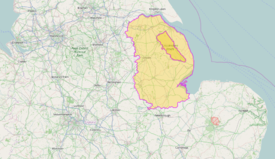
  The Lincolnshire Wolds near Stainton le Vale (top), location within Lincolnshire (bottom) | |
 | |
| Location | Lincolnshire North East Lincolnshire |
| Nearest city | Lincoln |
| Coordinates | 53°21′0″N 0°6′0″W / 53.35000°N 0.10000°W |
| Area | 560 km2 (220 sq mi) |
| Established | 1973 |
| Governing body | Lincolnshire Wolds Countryside Service |
The Lincolnshire Wolds which also includes the Lincolnshire Wolds National Landscape are a range of low hills in the county of Lincolnshire, England which runs roughly parallel with the North Sea coast, from the Humber Estuary just west of the town of Barton-upon-Humber in North Lincolnshire which then runs in a south easterly direction towards the flat Lincolnshire Fens in the south-east of the county as far south as the East Lindsey villege of East Keal. The Wolds form the highest land in eastern England between Yorkshire and Kent.[1][2] and also are a designated National Landscape although the area which is covered by this designation does not cover the entirety of the general area that makes up the Lincolnshire Wolds as a whole.
- ^ Ordnance Survey maps:
Lincolnshire Wolds North (Map) (A1 ed.). 1:25000. Explorer. Ordnance survey of Great Britain. 3 April 2006. § 282. ISBN 978-0319238233.
Lincolnshire Wolds South (Map) (A1 ed.). 1:25000. Explorer. Ordnance survey of Great Britain. 3 April 2006. § 273. ISBN 978-0319238219. - ^ "NCA Profile: 43 Lincolnshire Wolds (NE440)". Publications and products. Natural England. Retrieved 13 October 2013.