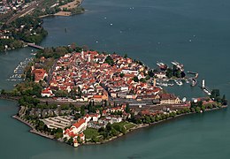
 The island of Lindau from the west | |
 | |
| Geography | |
|---|---|
| Location | Insel (district) |
| Coordinates | 47°32′44″N 09°40′58″E / 47.54556°N 9.68278°E |
| Adjacent to | Obersee, Lake Constance |
| Area | 0.68 km2 (0.26 sq mi) |
| Length | 1.3 km (0.81 mi) |
| Width | 0.666 km (0.4138 mi) |
| Highest elevation | 402 m (1319 ft) |
| Administration | |
| Demographics | |
| Population | 3000 |


On the island of Lindau in the eastern Lake Constance is the Altstadt of the Bavarian county town of Lindau, which occupies the eastern part of the island. The island of Lindau, which forms 2% of the area and 12% of the population of the entire town, is one of the town's ten administrative districts. The district is just called Insel ("Island").