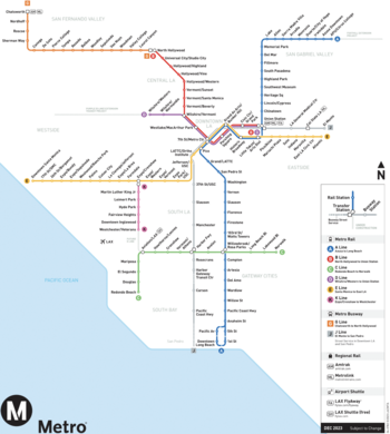
The Los Angeles Metro Rail is an urban rail transit system in Los Angeles County, California, operated by the Los Angeles County Metropolitan Transportation Authority (LACMTA or Metro). The system includes 101 metro stations with two rapid transit (known locally as a subway) and four light rail lines, covering 109 miles (175 km) of route service.[1] In 2019, the Metro Rail system served an average 295,889 passengers each weekday, totaling 93.2 million passengers in the calendar year.[2] Metro Rail is one of the largest rapid transit and light rail systems in the United States by ridership.[3] The system is complemented by two Metro Busway bus rapid transit lines.
- ^ "Facts At A Glance". Los Angeles County Metropolitan Transportation Authority. June 2023. Archived from the original on March 19, 2023. Retrieved June 22, 2023.
- ^ Cite error: The named reference
ridershipwas invoked but never defined (see the help page). - ^ "Transit Ridership Report, First Quarter 2011" (PDF). American Public Transportation Association. 2011-05-31. Archived from the original (PDF) on 2011-07-09. Retrieved 2011-09-18.