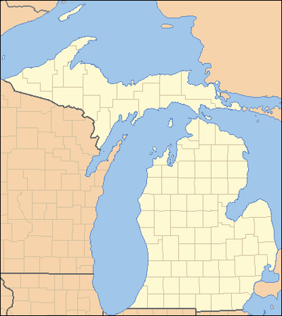
| Counties of Michigan | |
|---|---|
| Location | Michigan |
| Number | 83 |
| Populations | 2,172 (Keweenaw) – 1,751,169 (Wayne) |
| Areas | 508 square miles (1,320 km2) (Cass) – 5,966 square miles (15,450 km2) (Keweenaw) |
| Government | |
| Subdivisions | |
There are 83 counties in the U.S. state of Michigan. The boundaries of these counties have not changed substantially since 1897. However, throughout the 19th century, the state legislature frequently adjusted county boundaries. County creation was intended to fulfill the goal of establishing government over unorganized territory, but a more important goal was encouraging settlement by surveying the land and dividing it into saleable sections.
The creation of counties generally occurred in two stages. First the boundaries of a county were declared and given a name. The county appeared on maps, even though this may have been the entire extent of a county's tangible existence for several years. During this period, the as-yet–unorganized county was attached to another already organized county for administrative purposes. The legislature frequently changed the administrative attachment of these unorganized counties. Residents of such an attached county could petition the legislature for organization, which was the granting of full legal recognition to the county.
There are many cities and villages that span county boundaries in Michigan, including its capital, Lansing. For a few years during the early 1970s, split cities briefly had authority to petition to change the county boundaries to accord with the city boundaries. The only city to take advantage of this brief opportunity was New Baltimore (previously split between Macomb County and St. Clair County; now completely in Macomb). This transfer of territory from St. Clair to Macomb was the only county boundary change in Michigan since the early 20th century.
The state constitution of 1850 permitted an incorporated city with a population of at least 20,000 to be organized into a separate county of its own.[1] The Constitution of 1908 retained this provision, but raised the population threshold to 100,000.[2] No city was ever organized into an independent county in this fashion and when a new Constitution took effect in 1963, the provision was removed.
Michigan's boundary with Illinois is formed by Lake Michigan, and three counties have water boundaries with Illinois[citation needed]: Berrien County, Van Buren County, and Allegan County. Michigan also has a boundary with Minnesota, which is formed by Lake Superior. The water boundary in this instance is formed by two counties: Ontonagon County and Keweenaw County. The land boundary with Wisconsin continues into Lake Superior, involving both Gogebic County (which shares a land border) and Ontonagon County (water boundary only).

