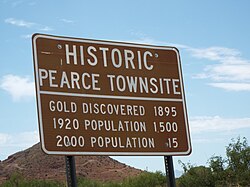
List of historic properties in Pearce, Arizona | |
|---|---|
 Historic Pearce Townsite | |
 | |
| Coordinates: 31°54′18″N 109°49′14″W / 31.90500°N 109.82056°W |
| Part of a series of the |
| Cities, towns and CDPs in Arizona with lists and images of historic properties, forts, cemeteries or historic districts |
|---|

This is a list of historic properties in Pearce, Arizona a former mining town which is now a census-designated area located between the Cochise Stronghold[1] and the Chiricahua National Monument,.[2] Pearce was once a thriving mining town which depended on the nearby Commonwealth Mine, a gold and silver mine and later became a ghost town after the mines were depleted. Included is a photographic gallery of some of the remaining historic structures, two of which are individually identified as historic by the National Register of Historic Places. .
- ^ "Cochise Stronghold – Coronado National Forest". Retrieved August 12, 2019.
- ^ "Chiricahua National Monument (U.S. National Park Service)". www.nps.gov. Retrieved August 12, 2019.
