Litchfield Park, Arizona | |
|---|---|
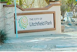
 Welcome sign | |
 Location in Maricopa County, Arizona | |
| Coordinates: 33°29′42″N 112°21′30″W / 33.49500°N 112.35833°W | |
| Country | United States |
| State | Arizona |
| County | Maricopa |
| Government | |
| • Mayor | Thomas L. Schoaf |
| Area | |
• Total | 3.31 sq mi (8.57 km2) |
| • Land | 3.28 sq mi (8.49 km2) |
| • Water | 0.03 sq mi (0.08 km2) |
| Elevation | 1,053 ft (321 m) |
| Population | |
• Total | 6,847 |
| • Density | 2,088.14/sq mi (806.18/km2) |
| Time zone | UTC-7 (MST (no DST)) |
| ZIP code | 85340 |
| Area code | 623 |
| FIPS code | 04-41330 |
| GNIS feature ID | 2410842[2] |
| Website | www |
Litchfield Park is a city in Maricopa County, Arizona, United States. It is located 19 miles (31 km) west of Phoenix. As of the 2020 census, the population of the city was 6,847,[3] up from 5,476 in 2010.[4]
- ^ "2021 U.S. Gazetteer Files: Arizona". United States Census Bureau. Retrieved May 9, 2022.
- ^ a b U.S. Geological Survey Geographic Names Information System: Litchfield Park, Arizona
- ^ a b "Litchfield Park city, Arizona: 2020 DEC Redistricting Data (PL 94-171)". U.S. Census Bureau. Retrieved May 9, 2022.
- ^ "U.S. Census website". United States Census Bureau. Retrieved June 18, 2014.


