| Little Colorado River Tółchíʼíkooh (in Navajo) Colorado Chiquito (in Spanish) | |
|---|---|
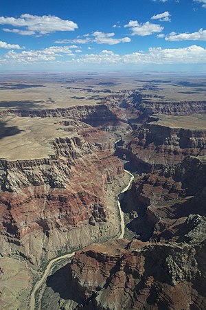
 The Little Colorado River carves a deep canyon just above its confluence with the Colorado | |
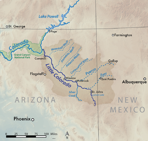
 Map showing the Little Colorado River basin. The Little Colorado River flows northwest through eastern Arizona to join the Colorado north of Flagstaff. | |
| Location | |
| Country | United States |
| States | Arizona, New Mexico |
| Region | Apache County, Navajo County, Coconino County |
| Physical characteristics | |
| Source | West Fork Little Colorado River |
| • location | Mount Baldy, White Mountains |
| • elevation | 10,000 ft (3,000 m) |
| 2nd source | East Fork Little Colorado River |
| Source confluence | |
| • location | Greer |
| • coordinates | 34°00′15″N 109°27′24″W / 34.00417°N 109.45667°W |
| • elevation | 8,359 ft (2,548 m) |
| Mouth | Colorado River |
• location | Grand Canyon, Coconino County |
• coordinates | 36°11′28″N 111°48′14″W / 36.19111°N 111.80389°W |
• elevation | 2,700 ft (820 m) |
| Length | 338 mi (544 km)[1] |
| Basin size | 26,500 sq mi (69,000 km2) |
| Discharge | |
| • average | 405 cu ft/s (11.5 m3/s) |
| • minimum | 150 cu ft/s (4.2 m3/s) |
| • maximum | 120,000 cu ft/s (3,400 m3/s) |
| Basin features | |
| River system | Colorado River |
| Tributaries | |
| • left | Silver Creek |
| • right | Zuni River, Puerco River |
The Little Colorado River (Hopi: Paayu) is a tributary of the Colorado River in the U.S. state of Arizona,[2] providing the principal drainage from the Painted Desert region. Together with its major tributary, the Puerco River, it drains an area of about 26,500 square miles (69,000 km2) in eastern Arizona and western New Mexico. Although it stretches almost 340 miles (550 km),[1] only the headwaters and the lowermost reaches flow year-round. Between St. Johns and Cameron, most of the river is a wide, braided wash, only containing water after heavy snowmelt or flash flooding.
The lower 57.2 miles (92.1 km) is known as the Little Colorado River Gorge[3] and forms one of the largest arms of the Grand Canyon, at over 3,000 feet (910 m) deep where it joins the Colorado near Desert View in Grand Canyon National Park. An overlook of the gorge is a Navajo Nation Tribal Park.
- ^ a b "USGS National Atlas Streamer". United States Geological Survey. Archived from the original on 2014-05-28. Retrieved 2015-01-10.
- ^ U.S. Geological Survey Geographic Names Information System: Little Colorado River
- ^ U.S. Geological Survey Geographic Names Information System: Little Colorado River Gorge