| Little Hartley New South Wales | |||||||||||||||
|---|---|---|---|---|---|---|---|---|---|---|---|---|---|---|---|
 Rosedale | |||||||||||||||
| Coordinates | 33°32′S 150°14′E / 33.533°S 150.233°E | ||||||||||||||
| Population | 629 (SAL 2021)[1] | ||||||||||||||
| Postcode(s) | 2790 | ||||||||||||||
| Elevation | 820 m (2,690 ft) | ||||||||||||||
| Location |
| ||||||||||||||
| LGA(s) | City of Lithgow | ||||||||||||||
| Parish | Lett | ||||||||||||||
| State electorate(s) | Bathurst | ||||||||||||||
| Federal division(s) | Macquarie (formerly Calare) | ||||||||||||||
| |||||||||||||||
| |||||||||||||||
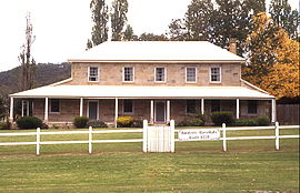
Little Hartley is a village in the Central West region of New South Wales, Australia. It is located approximately 150 kilometres west-northwest of Sydney and 20 kilometres south-east of Lithgow, on the Great Western Highway. It is in the local government area of the City of Lithgow, the state seat of Bathurst and the Federal Division of Calare.
- ^ Australian Bureau of Statistics (28 June 2022). "Little Hartley (suburb and locality)". Australian Census 2021 QuickStats. Retrieved 28 June 2022.
