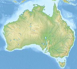
| Little Llangothlin Nature Reserve New South Wales | |
|---|---|
IUCN category IV (habitat/species management area) | |
| Nearest town or city | Llangothlin |
| Coordinates | 30°05′S 151°47′E / 30.083°S 151.783°E |
| Established | December 1979[1] |
| Area | 2.57 km2 (1.0 sq mi)[1] |
| Managing authorities | NSW National Parks and Wildlife Service |
| Website | Little Llangothlin Nature Reserve |
| Footnotes | |
| Designated | 17 March 1996 |
| Reference no. | 798[2] |
| See also | Protected areas of New South Wales |
| Little Llangothlin Lagoon | |
|---|---|
| Coordinates | 30°05′S 151°47′E / 30.083°S 151.783°E |
| Type | Freshwater, high altitude lake |
| Catchment area | Clarence River |
| Basin countries | Australia |
| Max. length | 1.38 km (0.86 mi) |
| Max. width | 1.17 km (0.73 mi) |
| Surface area | 1.20 km2 (0.46 sq mi) |
| Max. depth | 2 m (6 ft 7 in) |
| Surface elevation | 1,360 m (4,460 ft) |
The Little Llangothlin Nature Reserve is a protected wetland nature reserve that is located on the Northern Tablelands in the New England region of New South Wales, in eastern Australia. The 257-hectare (640-acre) reserve is situated approximately 10 kilometres (6.2 mi) north-east of the rural locality of Llangothlin, and some 20 kilometres (12 mi) north-east of Guyra.
The reserve contains the 120-hectare (300-acre) Little Llangothlin Lagoon, part of the smaller Billy Bung Lagoon, and was established in 1979 under the NSW National Parks and Wildlife Act 1974. In 1996 the reserve was designated a wetland of international importance under the Ramsar Convention. It, with the adjacent area of Bagot Road, is also listed on Australia’s Register of the National Estate.[3]
- ^ a b "Little Llangothlin Nature Reserve: Park management". Office of Environment and Heritage. Government of New South Wales. Retrieved 28 September 2014.
- ^ "Little Llangothlin Nature Reserve". Ramsar Sites Information Service. Retrieved 25 April 2018.
- ^ "Little Llangothlin Nature Reserve: Plants, animals and landscape". Office of Environment and Heritage. Government of New South Wales. Retrieved 12 July 2013.


