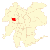
Lo Prado | |
|---|---|
|
| |
| Coordinates (city): 33°27′S 70°43.5′W / 33.450°S 70.7250°W | |
| Country | Chile |
| Region | Santiago Metro. |
| Province | Santiago |
| Government | |
| • Type | Municipality |
| • Alcalde | Gonzalo Navarrete Muñoz (PPD) |
| Area | |
| • Total | 6.7 km2 (2.6 sq mi) |
| Population (2002 Census)[3] | |
| • Total | 104,316 |
| • Density | 16,000/km2 (40,000/sq mi) |
| • Urban | 104,316 |
| • Rural | 0 |
| Sex | |
| • Men | 50,608 |
| • Women | 53,708 |
| Time zone | UTC-4 (CLT[4]) |
| • Summer (DST) | UTC-3 (CLST[5]) |
| Area code | 56 + |
| Website | Municipality of Lo Prado |
Lo Prado (Spanish pronunciation: [lo ˈpɾaðo]) is a Chilean commune located in Santiago, which is itself part of the Metropolitan region of Chile. It is part of the Greater Santiago urban area.
- ^ "Asociación Chilena de Municipalidades" (in Spanish). Archived from the original on 25 September 2002. Retrieved 27 January 2011.
- ^ "Municipality of Lo Prado" (in Spanish). Archived from the original on 25 September 2002. Retrieved 27 January 2011.
- ^ a b c "National Statistics Institute" (in Spanish). Retrieved 13 December 2010.
- ^ "Chile Time". WorldTimeZones.org. Archived from the original on 11 September 2007. Retrieved 26 September 2010.
- ^ "Chile Summer Time". WorldTimeZones.org. Archived from the original on 11 September 2007. Retrieved 26 September 2010.


