| Disputed island | |
|---|---|
 Loaita Cay | |
| Other names | Melchora Aquino Island (Philippine English) Pulo ng Melchora Aquino (Filipino) Đảo Loại Ta Tây (Vietnamese) 南鑰沙洲 / 南钥沙洲 Nányào Shāzhōu (Chinese) |
| Geography | |
| Location | South China Sea |
| Coordinates | 10°43′43″N 114°21′09″E / 10.72861°N 114.35250°E |
| Archipelago | Spratly Islands |
| Administration | |
| Region | IV-B - MIMAROPA |
| Province | Palawan |
| Municipality | Kalayaan |
| Claimed by | |
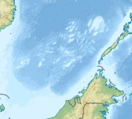
Loaita Cay, also known as Melchora Aquino Island (Filipino: Pulo ng Melchora Aquino; Vietnamese: Đảo Loại Ta Tây; Mandarin Chinese: 南鑰沙洲/南钥沙洲; pinyin: Nányào Shāzhōu), is an island in the Spratly Islands.[2] It has an area of 0.53 hectares (1.3 acres) and it's located about 5 nautical miles (9.3 km; 5.8 mi) northwest of Philippine-occupied Loaita (Kota) Island,[3] just west of the north of Dangerous Ground.[4]
The island is administered by the Philippines as part of Kalayaan, Palawan, and is the seventh largest of the Philippine-occupied islands. It is also claimed by the People's Republic of China, the Republic of China (Taiwan), and Vietnam.
- ^ "Peace in the South China Sea, National Territory Secure Forever: Position Paper on ROC South Clina Sea Policy" (PDF). ROC Ministry of Foreign Affairs. 2016. Retrieved 28 December 2021.
- ^ Loaita Cay on Asia Maritime Transparency Initiative.
- ^ Sailing Directions (Enroute), Pub. 161: South China Sea and the Gulf of Thailand (PDF). Sailing Directions. United States National Geospatial-Intelligence Agency. 2017. p. 13.
- ^ NGA Chart 93044 shows the area NW of Dangerous Ground.
