This article needs additional citations for verification. (June 2011) |
| Disputed island | |
|---|---|
 Loaita Island | |
| Other names | Kota Island (Philippine English) Pulo ng Kota (Filipino) Đảo Loại Ta (Vietnamese) 南鑰島 / 南钥岛 Nányào Dǎo (Chinese) |
| Geography | |
| Location | South China Sea |
| Coordinates | 10°40′N 114°25′E / 10.667°N 114.417°E |
| Archipelago | Spratly Islands |
| Administration | |
| Region | IV-B - MIMAROPA |
| Province | Palawan |
| Municipality | Kalayaan |
| Claimed by | |
| Additional information | |
 | |
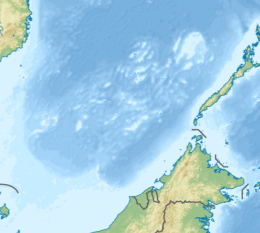
Loaita Island also known as Kota Island (Filipino: Pulo ng Kota; Mandarin Chinese: 南鑰島/南钥岛; pinyin: Nányào Dǎo, and Vietnamese: Đảo Loại Ta), with an area of 6.45 hectares (15.9 acres) -- is the tenth largest of the naturally-occurring Spratly Islands, and the fifth largest of the Philippine-occupied islands.[2] It is located just to the west of the northern part of Dangerous Ground, and is 22 miles (35 km) southeast of Philippine-occupied Thitu Island (Pag-asa) and 22 miles (35 km) north-northeast of Taiwan-occupied Itu Aba Island.[3]
The island is administered by the Philippines as part of Kalayaan, Palawan.
The island is also claimed by the People's Republic of China, the Republic of China (Taiwan) and Vietnam.
- ^ "Peace in the South China Sea, National Territory Secure Forever: Position Paper on ROC South Clina Sea Policy" (PDF). ROC Ministry of Foreign Affairs. 2016. Retrieved 28 December 2021.
- ^ PAO-MIN, CHANG (1990). "A New Scramble for the South China Sea Islands". Contemporary Southeast Asia. 12 (1): 20–39. doi:10.1355/CS12-1B. ISSN 0129-797X. JSTOR 42707646.
- ^ "Thitu Island". Asia Maritime Transparency Initiative. Retrieved 2021-01-17.
