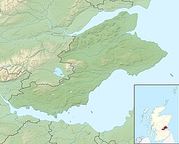
| Loch Gelly | |
|---|---|
| Loch Gheallaidh | |
 Gelly Loch | |
| Location | Fife, Scotland |
| Coordinates | 56°7′3″N 3°17′12″W / 56.11750°N 3.28667°W |
| Type | freshwater loch |
| Primary inflows | Lochgelly burn |
| Primary outflows | Lochgelly burn |
| Basin countries | Scotland |
| Max. length | 1.21 km (0.75 mi)[1] |
| Max. width | 0.80 km (0.5 mi)[1] |
| Average depth | 2.1 m (7 ft)[1] |
| Max. depth | 2.7 m (9 ft)[1] |
| Water volume | 910,000 m3 (32,000,000 cu ft)[1] |
| Surface elevation | 107.0 m (351.2 ft)[1] |
Loch Gelly (Scottish Gaelic: Loch Gheallaidh) is a small loch in Fife, Scotland lying approximately 1.5 km to the south east of the town of Lochgelly which itself is named after the loch. The Gaelic name of the loch, Loch Gheallaidh, can be loosely translated as Loch of Shining Waters or Loch of Brightness.[2] It is a broad, shallow flat bottomed basin approximately 1.75 km in length from west to east and 0.75 km wide at its maximum breadth.
In May 1583, Sir John Wemyss built a fort on the south side of the loch and kept an armed boat to prevent the Boswells of Balmuto from fishing in the loch.[3]
Land around the loch is owned by Wemyss 1952 Trustees.[4]
The loch was surveyed[1] on 11 May 1905 by Sir John Murray and later charted[5] as part of The Bathymetrical Survey of Fresh-Water Lochs of Scotland 1897-1909.[6]
- ^ a b c d e f g "Bathymetrical Survey of the Fresh-Water Lochs of Scotland, 1897-1909, Reservoirs of the Forth Basin". National Library of Scotland. 22 July 2013. Retrieved 22 July 2013.
- ^ "The Gelly Trust – Lochgelly Community Development Forum". The Gelly Trust. 23 July 2011. Archived from the original on 30 November 2011. Retrieved 22 July 2013..
- ^ William Fraser, Memorials of the family of Wemyss of Wemyss, vol. 1 (Edinburgh, 1888), p. 168.
- ^ "Who owns Lochgelly Loch? - Freedom of information request made to Fife Council". June 2010. Retrieved 22 July 2013..
- ^ "View: Loch Fitty; Loch Gelly; Harperleas Reservoir; Burn... - Bathymetrical Survey, 1897-1909 - National Library of Scotland". National Library of Scotland. Retrieved 22 July 2013.
- ^ Murray, John; Pullar, Laurence (1910). Bathymetrical Survey of Fresh-Water Lochs of Scotland during the years 1897 to 1909: report on scientific results. Edinburgh.
{{cite book}}: CS1 maint: location missing publisher (link)
