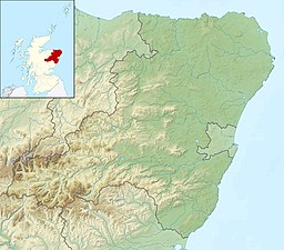
| Loch Muick | |
|---|---|
 Lock Muick from the eastern shore, looking west | |
| Location | Aberdeenshire, Scotland |
| Coordinates | 56°55′59″N 3°10′13″W / 56.93306°N 3.17028°W[1] |
| Type | freshwater loch |
| Primary inflows | Allt an Dubh loch[2] |
| Primary outflows | River Muick |
| Basin countries | Scotland |
| Max. length | 2.25 mi (3.62 km)[2] |
| Max. width | 0.33 mi (0.53 km)[2] |
| Surface area | 218.5 ha (540 acres)[1] |
| Average depth | 116 ft (35 m)[2] |
| Max. depth | 256 ft (78 m)[2] |
| Water volume | 2,771,000,000 cu ft (78,500,000 m3) |
| Shore length1 | 8.5 km (5.3 mi)[1] |
| Surface elevation | 398 m (1,306 ft)[1] |
| Islands | 0[1] |
| 1 Shore length is not a well-defined measure. | |
Loch Muick (/ˈmɪk/;[3] Gaelic: Uisge Muice (pronounced [ɯʃkʲəˈmɯçkʲə])) is an upland, freshwater loch lying approximately five miles (eight kilometres) south of Braemar, Scotland at the head of Glen Muick and within the boundary of the Balmoral estate.
- ^ a b c d e "Loch Muick". British lakes. British Lakes. Archived from the original on 2 January 2015. Retrieved 2 January 2015.
- ^ a b c d e "Bathymetrical Survey of the Fresh-Water Lochs of Scotland, 1897-1909, Lochs of the Dee (Aberdeen) Basin". National Library of Scotland. Retrieved 2 January 2015.
- ^ "Moray - Pronunciation". Rootsweb at ancestry.com. Retrieved 4 January 2015.
