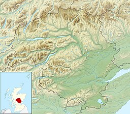
| Loch Tay | |
|---|---|
 Loch Tay and Ben Lawers | |
| Location | Perthshire, Scotland |
| Coordinates | 56°30′56″N 4°08′46″W / 56.51556°N 4.14611°W |
| Lake type | Loch |
| Primary inflows | Dochart, Lochay |
| Catchment area | 232 sq mi (600 km2)[1] |
| Basin countries | United Kingdom |
| Max. length | 14.55 mi (23.42 km)[1] |
| Max. width | 0.7 mi (1.1 km)[1] |
| Surface area | 10.19 sq mi (26.4 km2)[1] |
| Average depth | 60.66 m (199.0 ft)[1] |
| Max. depth | 154.8 m (508 ft)[1] |
| Water volume | 1.6 km3 (0.38 cu mi) |
| Shore length1 | 3 km (1.9 mi) |
| Surface elevation | 102 m (335 ft) |
| Islands | 7 |
| Settlements | Killin, Kenmore, Lawers, Ardeonaig |
| 1 Shore length is not a well-defined measure. | |
Loch Tay (Scottish Gaelic: Loch Tatha) is a freshwater loch in the central highlands of Scotland, in the Perth and Kinross and Stirling council areas, the largest body of fresh water in Perth and Kinross.[2] The watershed of Loch Tay traditionally formed the historic province of Breadalbane.
It is a long, narrow loch about 14.55 miles (23.42 km) long, and typically around 1 to 1.5 miles (1.6 to 2.4 km) wide, following the line of the strath from the south-west to north-east. It is the sixth-largest loch in Scotland by area and more 150 metres (490 ft) deep at its deepest.[3]
- ^ a b c d e f Bathymetrical Survey of the Fresh-Water Lochs of Scotland, 1897-1909, National Library of Scotland, 1909
- ^ Atkinson, John A.; Dalglish, Chris; Dixon, Nicholas T.; Donnelly, Michael; Harrison, John G.; Lelong, Olivia; MacGregor, Gavin; Bateson, J. D.; Clarke, Ann; Constable, Sue; Cox, Adrian (1 January 2016). "Ben Lawers: An Archaeological Landscape in Time. Results from the Ben Lawers Historic Landscape Project, 1996–2005". Scottish Archaeological Internet Reports. 62. doi:10.9750/issn.1473-3803.2016.62. ISSN 2056-7421.
- ^ "Lochs of the Tay Basin". maps.nls.uk. Retrieved 28 August 2021.
