| Loch of Harray | |
|---|---|
| Harray lch | |
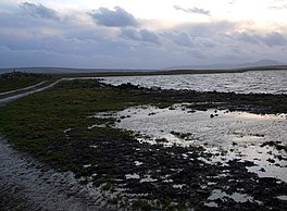
 Looking southwards along the shoreline | |
| Location | Mainland Orkney, Scotland |
| Coordinates | 59°1′24″N 3°13′40″W / 59.02333°N 3.22778°W[1] |
| Type | freshwater loch |
| Primary inflows | Burn of Hourston and Burn of Netherbrough[1] |
| Primary outflows | Loch of Stenness[2] |
| Catchment area | 45 sq mi (120 km2)[1] |
| Basin countries | Scotland |
| Max. length | 4.66 mi (7.50 km)[1] |
| Max. width | 1.75 mi (2.82 km)[1] |
| Surface area | 3.75 sq mi (9.7 km2)[1] |
| Average depth | 9 ft (2.7 m)[1] |
| Max. depth | 14 ft (4.3 m)[1] |
| Water volume | 951,000,000 cu ft (26,900,000 m3)[1] |
| Surface elevation | 3.6 ft (1.1 m)[1] |
| Islands | several islets and stones[1] |
The Loch of Harray is the largest loch of Mainland Orkney, Scotland[1] and is named for the parish of Harray. It lies immediately north of the Loch of Stenness and is close to the World Heritage neolithic sites of the Stones of Stenness and Ring of Brodgar.[3] In Old Norse its name was Heraðvatn.[4]
- ^ a b c d e f g h i j k l "Bathymetrical Survey of the Fresh-Water Lochs of Scotland, 1897-1909, Lochs of Orkney". National Library of Scotland. Retrieved 29 July 2013.
- ^ "Sites of Special Scientific Interest-SSSI, Orkney, Loch of Harray". Orkney Island Council. Retrieved 29 July 2013.
- ^ "World Heritage List - Heart of Neolithic Orkney". World Heritage Convention, UNESCO. Retrieved 4 August 2013.
- ^ Pedersen, Roy (January 1992) Orkneyjar ok Katanes (map, Inverness, Nevis Print)
