| Loch of Skene | |
|---|---|
| Loch Skene | |
 Loch of Skene in 1999 | |
| Location | Aberdeenshire, Scotland |
| Coordinates | 57°9′27″N 2°21′25″W / 57.15750°N 2.35694°W[1] |
| Type | freshwater artificial loch |
| Primary inflows | Corskie Burn[2] |
| Primary outflows | Leuchar Burn[3] |
| Basin countries | Scotland |
| Max. length | 1 mi (1.6 km)[4] |
| Max. width | 0.66 mi (1.06 km)[4] |
| Surface area | 144.4 ha (357 acres)[1] |
| Average depth | 6 ft (1.8 m)[4] |
| Max. depth | 6 ft (1.8 m)[4] |
| Water volume | 60,000,000 cu ft (1,700,000 m3)[4] |
| Shore length1 | 4.4 km (2.7 mi)[1] |
| Surface elevation | 85 m (279 ft)[1] |
| Islands | 3[1] |
| Designated | 1 October 1986 |
| Reference no. | 339[5] |
| 1 Shore length is not a well-defined measure. | |
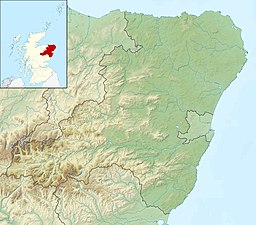
Loch of Skene is a large lowland, freshwater loch in Aberdeenshire, Scotland. It lies approximately 1 mi (1.6 km) to the west of the village of Kirkton of Skene and 9 mi (14 km) west of Aberdeen.[6]
The loch is partially man-made, being dammed at its outflow on the southern shore to form a reservoir. Before 1905, water from the loch was used in the making of tweed and to turn the mill wheel at the Garlogie Mills. The mills closed in 1905. From 1923, the water was used to generate electricity.[3][7] The loch is about 6 foot deep at its deepest.
- ^ a b c d e "Loch of Skene". British lakes. British Lakes. Retrieved 2 January 2015.
- ^ "Dee catchment, NE Scotland". REFRESH. Retrieved 3 January 2015.
- ^ a b "Garlogie Mill, Garlogie Dam". Canmore. Retrieved 3 January 2015.
- ^ a b c d e "Bathymetrical Survey of the Fresh-Water Lochs of Scotland, 1897-1909, Lochs of the Dee (Aberdeen) Basin". National Library of Scotland. Retrieved 2 January 2015.
- ^ "Loch of Skene". Ramsar Sites Information Service. Retrieved 25 April 2018.
- ^ Gazetteer for Scotland. "Skene, Loch of". Retrieved 3 January 2015.
- ^ "Domesday Reloaded". BBC. 1986. Archived from the original on 25 September 2015. Retrieved 3 January 2015.
