Loli | |
|---|---|
District | |
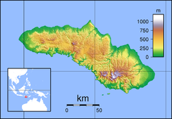
Location of Loli on Sumba | |
| Coordinates: 09°34′29″S 119°26′42″E / 9.57472°S 119.44500°E | |
| Country | Indonesia |
| Region | Lesser Sunda Islands |
| Province | East Nusa Tenggara |
| Regency | West Sumba Regency |
| Area | |
| • Total | 132.36 km2 (51.10 sq mi) |
| Population (mid 2022 estimate) | |
| • Total | 41,610 |
| • Density | 314.37/km2 (814.2/sq mi) |
| Time zone | UTC+8 |
Loli, historically also known as Lauli,[1] is a district (kecamatan) of West Sumba Regency, East Nusa Tenggara Province, Indonesia.[2] The district consists of nine rural villages (desa) and five urban villages (kelurahan) and has its seat in Doka Kaka village. The district has a total area of 132.36 square kilometres (51.10 sq mi) and had a population of 41,610 as at mid 2022.[3] The most populous village in the district is Soba Wawi, which had a population of 6,092 people in 2020, while the most densely populated village was Wee Karou with a density of 731.67 people per square kilometre.[2] The district is the site of Gollu Potto, a statue of Jesus which is one of the main landmarks of the regency itself and the largest in the island of Sumba.[4][5]
- ^ Vel, Jacqueline A. C. (2001). "Tribal Battle in a Remote Island: Crisis and Violence in Sumba (Eastern Indonesia)" (PDF). Indonesia (72): 141–158. doi:10.2307/3351484. hdl:1813/54235. JSTOR 3351484. Archived (PDF) from the original on 18 August 2022. Retrieved 28 July 2022.
- ^ a b "Kecamatan Loli dalam Angka 2021". sumbabaratkab.bps.go.id (in Indonesian). Archived from the original on 10 July 2022. Retrieved 23 July 2022.
- ^ Badan Pusat Statistik, Jakarta, 2023.
- ^ "TAMAN WISATA RELIGI GOLLU POTTO WAIKABUBAK SUMBA BARAT". Website Resmi Sumba Barat (in Indonesian). Archived from the original on 20 July 2022. Retrieved 23 July 2022.
- ^ Andryanto, S. Dian (9 July 2021). "5 Destinasi Wisata Patung Yesus di Indonesia, Paling Tinggi Ada di Pulau Samosir". Tempo (in Indonesian). Archived from the original on 11 July 2021. Retrieved 23 July 2022.
