This article needs additional citations for verification. (September 2016) |
Lom Sak
หล่มสัก | |
|---|---|
District | |
 | |
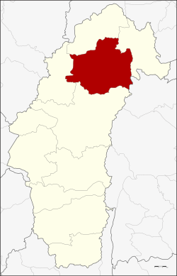
 District location in Phetchabun province | |
| Coordinates: 16°46′46″N 101°14′32″E / 16.77944°N 101.24222°E | |
| Country | Thailand |
| Province | Phetchabun |
| Area | |
| • Total | 1,535.3 km2 (592.8 sq mi) |
| Population (2000) | |
| • Total | 150,680 |
| • Density | 98.1/km2 (254/sq mi) |
| Time zone | UTC+7 (ICT) |
| Postal code | 67110 |
| Geocode | 6703 |
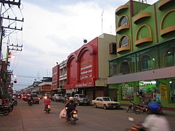
Lom Sak (Thai: หล่มสัก, pronounced [lòm sàk]) is a district (amphoe) in the northern part of Phetchabun province, northern Thailand.