Long An | |
|---|---|
 Downtown of Tân An city with Bảo Định river | |
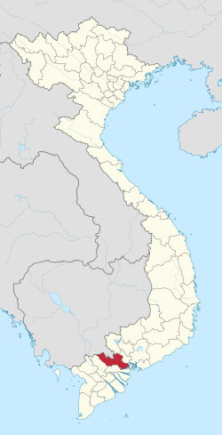
 Location of Long An within Vietnam | |
 | |
| Coordinates: 10°40′N 106°10′E / 10.667°N 106.167°E | |
| Country | |
| Region | Mekong Delta |
| Metropolitan area | Ho Chi Minh City metropolitan area |
| Capital | Tân An |
| Government | |
| • People's Council Chair | Nguyễn Văn Được |
| • People's Committee Chair | Nguyễn Văn Út |
| Area | |
• Total | 4,494.79 km2 (1,735.45 sq mi) |
| Population (2023)[2] | |
• Total | 1,743,400 |
| • Density | 390/km2 (1,000/sq mi) |
| Demographics | |
| • Ethnicities | Vietnamese, Hoa, Khmer |
| GDP[3] | |
| • Total | VND 168.108 trillion US$ 7.053 billion (2023) |
| Time zone | UTC+7 (ICT) |
| Calling code | 72 |
| ISO 3166 code | VN-41 |
| HDI (2020) | (27th) |
| Website | eng |

Long An is a province in the Mekong Delta region of southern Vietnam. The provincial capital is Tân An city, and other major districts and town include Kiến Tường, Bến Lức, Cần Giuộc and Đức Hòa. There are 15 districts within the province (included 1 provincial capital city and 1 district-level town).[5]
The region is between Ho Chi Minh City and Southeast region in the north and the Mekong Delta. Because of its low lying geography, it is susceptible to sea level rise caused by climate change.
- ^ Biểu số 4.6: Hiện trạng sử dụng đất vùng Đồng Bằng Sông Cửu Long năm 2022 [Table 4.6: Current land use status in the Mekong Delta in 2022] (PDF) (Decision 3048/QĐ-BTNMT) (in Vietnamese). Ministry of Natural Resources and Environment (Vietnam). 18 October 2023. – the data in the report are in hectares, rounded to integers
- ^ Statistical Handbook of Vietnam 2014 Archived 2015-07-06 at the Wayback Machine, General Statistics Office Of Vietnam
- ^ "Long An: Economic increase ranks 13th in the country".
- ^ "Human Development Index by province(*) by Cities, provincies and Year". General Statistics Office of Vietnam. Retrieved September 28, 2024.
- ^ Long An Government