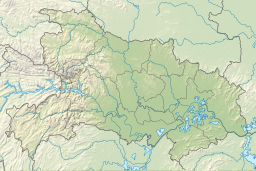
| Longgan Lake | |
|---|---|
| Location | Susong County, Anhui Huangmei County, Hubei |
| Coordinates | 29°55′47″N 116°05′39″E / 29.9297°N 116.0943°E |
| Basin countries | China |
| Max. length | 29.5 km (18 mi) |
| Max. width | 21.1 km (13 mi) |
| Surface area | 316.2 km2 (100 sq mi) |
| Average depth | 3.78 m (12 ft) |
| Max. depth | 4.58 m (15 ft) |
| Water volume | 1,196×106 m3 (42.2×10⁹ cu ft) |
| Surface elevation | 15 m (49 ft) |
Longgan Lake (simplified Chinese: 龙感湖; traditional Chinese: 龍感湖; pinyin: Lónggǎn Hú) is a freshwater lake in central China, divided between Susong County of Anhui Province and Huangmei County at the eastern extremity of Hubei Province. The lake is situated near the north bank of the middle reaches of Yangtze River, opposite Poyang Lake (which is south of the Yangtze). The lake was named Longgan Lake in a 1955 decision which combined the names of two former lakes, Long Lake (龙湖) and Gan Lake (感湖).[1]
At of 1998, the lake's water surface area was 316.2 square kilometres (100 sq mi).[2] It is an important marsh protective area.[3] Longgan Lake is an important aquatic farming area.[4]
- ^ 龙感湖管理区(农场 [Longganhu Administrative District (Farm)] (in Chinese). XZQH. 8 August 2014. Retrieved 15 January 2018.
1955年,中央长江水利规划办公室正式下文,将龙湖、感湖合并称为"龙感湖"。
- ^ Sumin, Wang; Hongshen, Dou (1998). Lakes in China. Beijing: Science Press. p. 235. ISBN 7-03-006706-1.
- ^ 湖北龙感湖国家级自然保护区简介. Wetlands China. Retrieved 2018-10-27.
湖北龙感湖国家级自然保护区地处长江中下游的湖北黄梅县境内,南与江西省著名的庐山风景名胜区隔长江相望,东与安徽省安庆沿江湿地相连,地理座标为东经115°56′~116°07′,北纬29°49′~30°04′之间,2009年9月18日,经国务院办公厅国办发[2009]54号文批准成立国家级自然保护区,总面积为22322h㎡,是由湖泊、滩涂、草甸等组成的以生物多样性和内陆水域生态系统为主要保护对象的湿地类型自然保护区,是我国众多淡水湖泊中保持最为完好的重要湖泊湿地之一。
- ^ http://www.ndrc.gov.cn/zcfb/zcfbtz/201504/t20150416_688229.html Archived 2015-12-08 at the Wayback Machine page 26 水产品基地:{...} 龙感湖。pdf also at https://commons.wikimedia.orgview_image.php?q=Longgan_Lake&sq=Qlik&lang=&file=File:长江中游城市群发展规划.pdf
