| Longhorsley | |
|---|---|
 Longhorsley | |
Location within Northumberland | |
| Population | 887 (2011 census) |
| OS grid reference | NZ145945 |
| Unitary authority | |
| Ceremonial county | |
| Region | |
| Country | England |
| Sovereign state | United Kingdom |
| Post town | MORPETH |
| Postcode district | NE65 |
| Dialling code | 01670 |
| Police | Northumbria |
| Fire | Northumberland |
| Ambulance | North East |
| UK Parliament | |
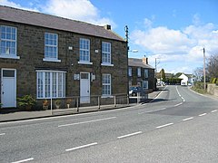
Longhorsley is a village in Northumberland, England about 7 miles (11 km) northwest of Morpeth, and about 14 miles (23 km) south of Alnwick. The A697 road passes through the village linking it with Morpeth, Wooler and Coldstream in Scotland.[1] There are 8 "Streets" in Longhorsley: Whitegates, Church View, Drummonds Close, South Road, West Road, East Road and Reivers Gate, Wilding Place and (Davison Court within Wilding Place).The village is bordered on the north by the River Coquet. The village formerly lay in three separate townships: Bigges Quarter, Freeholders Quarter and Riddells Quarter.[1]
Local amenities at present include: St Helen's First School; Millar's Shop; Albion House Hairdressing; and The Shoulder of Mutton Pub.
The population of Longhorsley Parish is approximately 800, measured at the 2011 Census as 887,[2] and is essentially a residential community for those who work in South Northumberland and Tyneside.[1]
- ^ a b c "Northumberland Communities". Retrieved 11 December 2008.
- ^ "Parish population 2011". Retrieved 26 June 2015.
