Lonoke County | |
|---|---|
| County of Lonoke | |
 | |
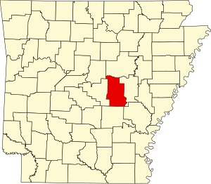
 Location within the U.S. state of Arkansas | |
 Arkansas's location within the U.S. | |
| Coordinates: 34°46′41″N 91°52′18″W / 34.77806°N 91.87167°W | |
| Country | |
| State | |
| Formed | April 16, 1874 |
| Named for | "Lone oak" |
| Seat | Lonoke |
| Largest city | Cabot |
| Area | |
| • Total | 803 sq mi (2,080 km2) |
| • Land | 771 sq mi (2,000 km2) |
| • Water | 32 sq mi (80 km2) 4.0% |
| Population (2020) | |
| • Total | 74,015 |
| • Density | 92/sq mi (36/km2) |
| Time zone | UTC−6 (Central) |
| • Summer (DST) | UTC−5 (CDT) |
| ZIP Codes | 72007, 72023, 72024, 72037, 72046, 72072, 72076, 72083, 72086, 72142, 72160, 72176 |
| Congressional district | 1st |
Lonoke County is a county located in the Central Arkansas region of the U.S. state of Arkansas. As of the 2020 census, the population was 74,015, making it the 10th-most populous of Arkansas's 75 counties.[1] The county seat is Lonoke and largest city is Cabot.[2] Included in the Central Arkansas metropolitan area, with Little Rock as the principal city, it is an alcohol prohibition or dry county.
- ^ "Census - Geography Profile: Lonoke County, Arkansas". United States Census Bureau. Retrieved January 20, 2023.
- ^ "Find a County". National Association of Counties. Retrieved June 7, 2011.