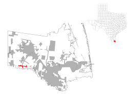
Los Indios, Texas | |
|---|---|
 Location of Los Indios, Texas | |
 | |
| Coordinates: 26°2′59″N 97°44′25″W / 26.04972°N 97.74028°W | |
| Country | United States |
| State | Texas |
| County | Cameron |
| Founded | 1913 |
| Area | |
| • Total | 1.88 sq mi (4.88 km2) |
| • Land | 1.88 sq mi (4.86 km2) |
| • Water | 0.01 sq mi (0.02 km2) |
| Elevation | 56 ft (17 m) |
| Population (2020) | |
| • Total | 1,008 |
| • Density | 565.33/sq mi (218.26/km2) |
| Time zone | UTC-6 (Central (CST)) |
| • Summer (DST) | UTC-5 (CDT) |
| ZIP code | 78567 |
| Area code | 956 |
| FIPS code | 48-44128[2] |
| GNIS feature ID | 1374728[3] |
Los Indios is a U.S. border town in Cameron County, Texas. The population was 1,008 at the 2020 census. It is included as part of the Brownsville–Harlingen–Raymondville and the Matamoros–Brownsville metropolitan areas. The Free Trade International Bridge connects Los Indios with Matamoros, Tamaulipas.
- ^ "2019 U.S. Gazetteer Files". United States Census Bureau. Retrieved August 7, 2020.
- ^ "U.S. Census website". United States Census Bureau. Retrieved January 31, 2008.
- ^ "US Board on Geographic Names". United States Geological Survey. October 25, 2007. Retrieved January 31, 2008.