| Lower Longley Hobart, Tasmania | |||||||||||||||
|---|---|---|---|---|---|---|---|---|---|---|---|---|---|---|---|
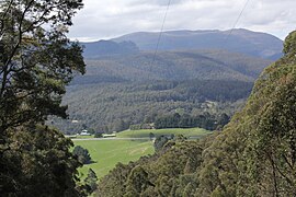
 The highest point of the Huon Highway at Vinces Saddle in Lower Longley | |||||||||||||||
 | |||||||||||||||
| Population | 267 (SAL 2021)[1] | ||||||||||||||
| Postcode(s) | 7109 | ||||||||||||||
| LGA(s) | Huon Valley, Kingborough. | ||||||||||||||
| State electorate(s) | |||||||||||||||
| Federal division(s) | |||||||||||||||
| |||||||||||||||
Lower Longley is a rural locality situated on the borders of the Kingborough and Huon Valley local government areas, which straddles the Huon Highway and is made up primarily of acreage properties. Lower Longley had 131 inhabitants as of the 2011 Australian Census.[2] Despite being called Lower Longley, the suburb is physically higher than neighbouring Longley.
- ^ Australian Bureau of Statistics (28 June 2022). "Lower Longley (suburb and locality)". Australian Census 2021 QuickStats. Retrieved 28 June 2022.
- ^ "2011 Census QuickStats: Lower Longley". Censusdata.abs.gov.au. Retrieved 5 August 2013.