| Lower Neponset River Trail | |
|---|---|
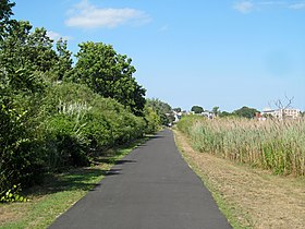
 Neponset Trail east of Shawmut underpass in 2016 | |
| Length | 2.4 mi (3.9 km) |
| Location | Dorchester, Massachusetts to Mattapan, Massachusetts |
| Trailheads | Port Norfolk, Dorchester; River Street, Mattapan (42°16′12″N 71°04′24″W / 42.269965°N 71.073249°W) |
| Use | Hiking, bicycling |
| Difficulty | Easy |
| Season | Year-round |
| Sights | Marsh, mills |
The Lower Neponset River Trail is a 2.4-mile-long (3.9 km) rail trail running along the Neponset River in the Dorchester section of Boston, Massachusetts.[1] It roughly follows the path of the eastern part of the Dorchester and Milton Branch Railroad from the Port Norfolk neighborhood in Dorchester to the Central Avenue T Station in Milton,[2] passing through Pope John Paul II Park, the Neponset Marshes, and the Lower Mills area.[3]