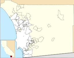
| Lower Otay Reservoir | |
|---|---|
 | |
| Location | San Diego County, California |
| Coordinates | 32°38′14″N 116°55′30″W / 32.6372°N 116.9249°W |
| Type | Reservoir |
| Part of | Otay and Proctor Valleys[1] |
| Primary inflows | Otay River San Diego Aqueduct |
| Primary outflows | Otay River |
| Basin countries | United States |
| Managing agency | City of San Diego |
| Surface area | 1,100 acres (450 ha)[2] |
| Average depth | 124 ft (38 m) (August 2009)[3] |
| Max. depth | 137.5 ft (41.9 m)[2] |
| Water volume | 49,500 acre⋅ft (61.1×10⁶ m3) |
| Shore length1 | 25 mi (40 km)[2] |
| Surface elevation | 381 ft (116 m) |
| Website | www |
| References | U.S. Geological Survey Geographic Names Information System: Lower Otay Reservoir |
 | |
| 1 Shore length is not a well-defined measure. | |
Lower Otay Reservoir is a reservoir in San Diego County, California. It is flanked by Otay Mountain to the southeast, the Jamul Mountains to the east, Otay Lakes Road and Upper Otay Reservoir to the north, and the city of Chula Vista to the west.
The reservoir is formed by impounding the waters of the Otay River, behind Savage Dam, completed in 1918, and is also the terminus for the second San Diego Aqueduct,[4] which transports imported water from the Colorado River.[5] The dam and reservoir are owned by the City of San Diego.
- ^ Common Grounds Project (2006). "The Otay Watershed (HU 910.00)". San Diego Bay Watersheds. San Diego State University. Retrieved 2009-03-22.
- ^ a b c "Lower Otay Reservoir". Water department. City of San Diego. Retrieved 17 August 2009.
- ^ "Water Levels". Water Department. City of San Diego. Retrieved 17 August 2009.
- ^ Water Department (2005). "Watershed Sanitary Survey". City of San Diego: Volume 3.
{{cite journal}}: Cite journal requires|journal=(help) - ^ Norman Durfor, Charles; Becker, Edith (1962). Public Water Supplies of the 100 Largest Cities in the United States, 1962, Issue 1812. Government Printing Office. p. 133. Retrieved 2 September 2014.


