Luang Namtha province
ແຂວງ ຫລວງນໍ້າທາ | |
|---|---|
 | |
 Map of Luang Namtha province | |
 Location of Luang Namtha province in Laos | |
| Coordinates: 20°57′25″N 101°23′42″E / 20.956944°N 101.395°E | |
| Country | Laos |
| Capital | Luang Namtha |
| Area | |
• Total | 9,325 km2 (3,600 sq mi) |
| Population (2020 census) | |
• Total | 199,090 |
| • Density | 21/km2 (55/sq mi) |
| Time zone | UTC+7 (ICT) |
| ISO 3166 code | LA-LM |
| HDI (2018) | 0.576[1] medium · 7th |
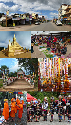
Luang Namtha (Lao: ຫລວງນໍ້າທາ, pronounced [lǔaŋ nâːm.tʰáː]; literally 'royal sugar palm' or "'royal green river') is a province of Laos in the country's north. From 1966 to 1976 it formed, together with Bokeo, the province of Houakhong. Luang Namtha province covers an area of 9,325 square kilometres (3,600 sq mi). Its provincial capital is Luang Namtha. The province borders Yunnan, China to the north, Oudomxai province to the east and southeast, Bokeo province to the southwest, and Shan State, Myanmar to the northwest.
The province contains the Nam Ha National Biodiversity Conservation Area and is one of the main sugar cane and rubber producing areas of Laos with numerous plantations. There are some 20 temples in Muang Sing, including Wat Sing Jai and Wat Namkeo. The anthropological Luang Namtha Museum is in Luang Namtha.
- ^ "Sub-national HDI - Area Database - Global Data Lab". hdi.globaldatalab.org. Retrieved 2018-09-13.