Lubbock County | |
|---|---|
 The current Lubbock County Courthouse | |
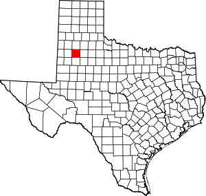
 Location within the U.S. state of Texas | |
 Texas's location within the U.S. | |
| Coordinates: 33°37′N 101°49′W / 33.61°N 101.82°W | |
| Country | |
| State | |
| Founded | 1891 |
| Named for | Thomas Saltus Lubbock |
| Seat | Lubbock |
| Largest city | Lubbock |
| Area | |
• Total | 901 sq mi (2,330 km2) |
| • Land | 896 sq mi (2,320 km2) |
| • Water | 5.1 sq mi (13 km2) 0.6% |
| Population (2020) | |
• Total | 310,639 |
| • Density | 340/sq mi (130/km2) |
| Time zone | UTC−6 (Central) |
| • Summer (DST) | UTC−5 (CDT) |
| Congressional district | 19th |


Lubbock County is a county located in the U.S. state of Texas. The 2020 census placed the population at 310,639.[1] Its county seat and largest city is Lubbock.[2] The county was created in 1876 and organized in 1891.[3] It is named for Thomas Saltus Lubbock,[4] a Confederate colonel and Texas Ranger (some sources give his first name as Thompson).
Lubbock County, along with Crosby County, and Lynn County, is part of the Lubbock Metropolitan Statistical Area (MSA). The Lubbock MSA and Levelland Micropolitan Statistical Area, encompassing only Hockley County, form the larger Lubbock–Levelland Combined Statistical Area.
- ^ "Lubbock County, Texas". United States Census Bureau. Retrieved January 30, 2022.
- ^ "Find a County". National Association of Counties. Retrieved June 7, 2011.
- ^ "Texas: Individual County Chronologies". Texas Atlas of Historical County Boundaries. The Newberry Library. 2008. Retrieved May 25, 2015.
- ^ Gannett, Henry (1905). The Origin of Certain Place Names in the United States. U.S. Government Printing Office. p. 191.