| Lubuge Dam | |
|---|---|
| Country | China |
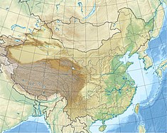
| Location | Lubugexiang, Luoping County, Qujing, Yunnan/Guizhou |
| Coordinates | 24°51′58.72″N 104°34′47.47″E / 24.8663111°N 104.5798528°E |
| Purpose | Power |
| Status | Operational |
| Construction began | 1982 |
| Opening date | 1988 |
| Dam and spillways | |
| Type of dam | Embankment, rock-fill |
| Impounds | Huangni River |
| Height | 101 m (331 ft) |
| Length | 217.2 m (713 ft) |
| Width (crest) | 10 m (33 ft) |
| Spillway capacity | Main: 6,424 m3/s (226,900 cu ft/s) Left bank tunnel: 1,995 m3/s (70,500 cu ft/s) Right bank tunnel: 1,658 m3/s (58,600 cu ft/s) |
| Reservoir | |
| Total capacity | 110,000,000 m3 (89,000 acre⋅ft) |
| Catchment area | 7,300 km2 (2,800 sq mi) |
| Normal elevation | 1,130 m (3,710 ft) |
| Lubuge Hydropower Station | |
| Coordinates | 24°47′20.20″N 104°32′20.23″E / 24.7889444°N 104.5389528°E |
| Commission date | 1988-1991 |
| Hydraulic head | 327.7 m (1,075 ft) |
| Turbines | 4 x 150 MW Francis-type |
| Installed capacity | 600 MW |
The Lubuge Dam (Chinese: 鲁布革水电站) is a rock-fill embankment dam on the Huangni River, a tributary of the Nanpan River, located near Lubugexiang in Luoping County on the border of Guizhou and Yunnan Provinces, China. The primary purpose of the dam is hydroelectric power generation and it supports a 600 MW power station. Construction on the project began in 1982 and it was completed in 1991. Funded by the World Bank, it was the first loan offered by the bank to China's power sector.[1]
- ^ "Project Completion Report – China - Lubuge Hydroelectric Project" (PDF). World Bank. 22 November 1993. Retrieved 8 June 2014.
"This was the first Bank loan to the power sector in China." - PDF Page 3 (Memorandum)
